GPS Coordinates
Big Burgers is coming to New York City. To figure out where to put their first new restaurant, the restaurant chain put up signs asking people to use their phones at home to send their location. These locations were recorded using GPS coordinates.
- Load your U4L2-GPSData project from Lab 1, reading the GPS coordinates into a list of two-item lists.
- How many people reported their location?
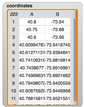
When read into Snap!, the list of lists looks like this:

Each line of data gives a latitude and longitude, a pair of GPS coordinates. GPS, the Global Positioning System, has changed how people travel, navigate, and find information about locations all over the world.
